Archive for the ‘Weather’ Category

A more “local” forecast

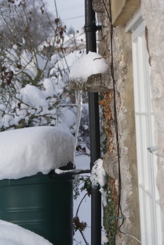
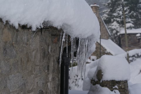
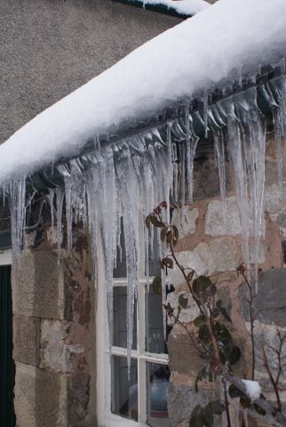
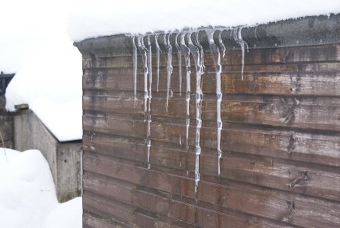
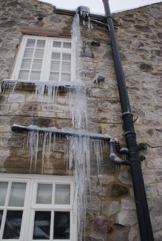
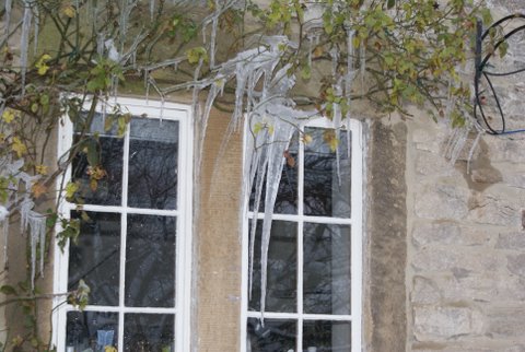
The Met Office has released information to the effect that site specific site forecasts are increased from 480 to 5,000, this means very much more local forecasts which will be updated twice daily. The location or DE6 post code gives a choice of five locations – Ashbourne, Ilam Youth hostel, Alton Towers, Dimmingsdale Youth Hostel and Uttoxeter Race Course. The information is available from the Met Office by mobile phone, Weather Widget, or the  Invent area of the Met Office web site.  Click on this link and then type Ashbourne into the drop down box of the region section of the site and you can then select one of the five location for our area.

It should be noted that this section of the Met Office website is new and the content will be regularly changed and is being continuously developed so things might not always work as expected. Met Office Invent should not be used to make operational or personal decisions.  Met Office Invent will showcase some of our future plans for presenting web-based weather forecasts, products and information. It will allow you to become involved in the formation of new weather and climate change products, services or forecasts. For up-to-date forecasts you should visit the  main forecast section of the Met Office website for East Midlands.

Thank you to the weatherman on the hill for spotting this information.

Read Full Post »

Here are last week’s readings:

Rainfall

in mm

Pressure

in Mb am

Pressure

in Mb pm

Temperature in ºC

Max

Min

Sun 27

1.8

1019.1

1022.2

7.5

3.1

Mon 28

0.5

1029.8

1033.0

4.5

2.7

Tue 1

0.0

1036.6

1036.0

9.0

1.9

Wed 2

0.0

1036.5

1034.3

5.4

1.4

Thu 3

0.0

1034.2

1032.5

4.3

-0.8

Fri 4

0.0

1031.8

1029.9

4.7

1.7

Sat 5

0.4

1028.6

1029.5

6.9

-1.3

Total

2.7

Average

6.05

1.25

Our weatherman on the hill says:

A little sun to start the week but westerly air flows will bring a mixed bag of weather though a little warmer than this last week.

Read Full Post »

Brr, what a winter!

Now that we have reached the month of March, with spring time hopefully just around the corner, let’s take a look back at the last six months of Parwich weather, based on the daily maximum and minimum temperatures supplied by our “weatherman on the hill”.

With the “great freeze” of December 2010 still fresh in our memories, it scarcely seems possible to imagine a warm, sunny day in Parwich – and as our figures show, we haven’t enjoyed a temperature of over 20 degrees since Thursday September 9th. However, a warm spell in early November gave us an unexpected high of 16.4 degrees on Thursday November 4th – after which, it was downhill all the way.

Just nine days later, on Saturday November 13th, the maximum temperature in Parwich reached double figures for the last time in 2010 – and it didn’t rise to double figures again until Thursday January 13th, exactly two months later.

Although our first sub-zero temperature was recorded overnight on Monday October 25th, the first “great freeze” didn’t start in earnest until Wednesday November 24th. This marked the first of a whopping sixteen consecutive sub-zero nights, lasting until Thursday December 9th. During that time, the temperature dipped below minus 10 degrees on four nights, reaching its coldest – a positively Arctic minus 12.2 degrees – on Monday December 6th. Other villagers reported tempertaures as low as minus 15.5 degrees on the same morning – while out by Tissington Ford, one driver from the village recorded a gobsmacking minus 22 degrees.

Parwich’s second major cold spell struck on Friday December 17th, just in time for Christmas. This time round, the sub-zero nights lasted eleven days, ending on Monday December 27th. And for the five day period between December 17th and Monday December 21st, the maximum temperature in the village never once rose above zero.

During January and February, things started to improve – despite a further cold spell at the end of January, and a somewhat chilly mid-February. We had five days of double-figure mildness from Friday February 4th to Tuesday February 8th, our last sub-zero temperature was recorded in the early morning of Tuesday February 8th, and last Thursday’s 13.4 degree maximum gave us our warmest day since early November.

For the stats-lovers amongst you, here are some charts, which illustrate the last six months of maximum and minimum temperatures: from September 1st to February 26th.

(more…)

Read Full Post »

Weather stats: Feb 20th to Feb 26th

Here are last week’s readings:


Rainfall

in mm

Pressure

in Mb am

Pressure

in Mb pm

Temperature in ºC

Max

Min

Sun 20

0.0

1016.0

1015.7

3.4

2.2

Mon 21

2.5

1013.5

1014.4

4.1

1.1

Tue 22

0.4

1015.2

1016.4

6.4

2.3

Wed 23

2.6

1014.2

1013.6

10.4

4.2

Thu 24

0.0

1018.1

1020.9

13.4

6.4

Fri 25

6.2

1019.0

1017.9

12.1

7.2

Sat 26

6.6

1011.6

1016.6

9.2

4.8

Total

17.9


Average

8.43

4.03

Our weatherman on the hill says:

Another cloudy, cool, mainly dry, week to come with the possibility of a slight frost midweek, and there may be a little sun on Thursday.

Read Full Post »

Weather stats: Feb 13th to Feb 19th

Here are last week’s readings:

Rainfall

in mm

Pressure

in Mb am

Pressure

in Mb pm

Temperature in ºC

Max

Min

Sun 13

9.4

1002.3

999.0

7.6

1.1

Mon 14

0.9

1006.6

1001.6

7.4

2.3

Tue 15

7.6

997.0

992.7

4.8

0.3

Wed 16

0.0

998.0

1002.0

6.9

1.9

Thu 17

0.4

1008.6

1012.3

6.0

3.0

Fri 18

0.0

1013.3

1013.5

4.4

2.7

Sat 19

10.8

1012.8

1013.7

3.4

0.4

Total

29.1

Average

5.79

1.68

Our weatherman on the hill says:

A cool cloudy start to the week with some rain or sleet possible. Temperatures 3C to 5C to begin the week and then climbing to 10C to 13C from Wednesday onwards.

Read Full Post »

Weather stats: Feb 6th to Feb 12th

Here are last week’s readings:

Rainfall

in mm

Pressure

in Mb am

Pressure

in Mb pm

Temperature in ºC

Max

Min

Sun 6th

3.9

1010.5

1011.2

11.3

8.9

Mon 7th

0.4

1005.9

1014.2

11.4

7.7

Tue 8th

0.0

1020.2

1019.8

11.4

-1.0

Wed 9th

0.9

1017.0

1014.4

9.6

2.7

Thu 10th

3.1

1011.7

1012.4

9.0

6.5

Fri 11th

3.1

1011.4

1011.4

9.7

4.8

Sat 12th

1.8

1011.5

1010.4

10.7

5.7

Total

13.2

Average

10.35

5.05

Our weatherman on the hill says:

Looks like another cloudy week to come with some rain, a light frost overnight on occasions, and Monday being the best day.

Read Full Post »

This week’s weather

Here are last week’s readings:

Rainfall

in mm

Pressure

in Mb am

Pressure

in Mb pm

Temperature in ºC

Max

Min

Sun 30th

0.0

1023.2

1021.3

2.8

-0.3

Mon 31st

0.0

1022.3

1020.6

1.7

-6.6

Tue 1st

1.3

1019.5

1019.8

9.4

-1.9

Wed 2nd

0.0

1020.0

1015.5

9.0

2.8

Thu 3rd

1.3

1019.0

1009.8

8.4

2.7

Fri 4th

7.2

1010.1

1008.4

11.4

3.0

Sat 5th

30.2

1007.8

1009.8

11.3

10.3

Total

40.0

Average

7.72

1.43

Our weatherman on the hill says:

A cloudy week with a little sun at times and some rain. No frosts expected and daytime teperatures about 6C to 8C.

Read Full Post »

This week’s weather

Normal service has been resumed from Wednesday January 26th.

Rainfall

in mm

Pressure

in Mb am

Pressure

in Mb pm

Temperature in ºC

Max

Min

Wed26th

0.4

1011.0

1015.5

5.6

2.5

Thu 27th

0.0

1023.0

1023.0

2.2

-0.3

Fri 28th

0.0

1025.2

1021.8

3.6

-1.4

Sat 29th

0.0

1022.4

1022.2

1.3

-4.6

Total

0.4

Average

3.18

-0.95

Our weatherman on the hill says:

Atlantic weather moving in, so it will be less cold with westerly winds, but not very much sunshine and the possibility of a slight overnight frost on one two nights.

Read Full Post »

This week’s weather

As our “weatherman on the hill” is away for the weekend, this week’s readings are from Sunday to Thursday only:

Rainfall

in mm

Pressure

in Mb am

Pressure

in Mb pm

Temperature in ºC

Max

Min

Sun 16th

0.0

1008.4

1013.7

10.9

8.4

Mon 17th

0.0

1015.8

1018.0

8.3

2.4

Tue 18th

0.4

1023.0

1029.0

7.1

0.4

Wed19th

0.4

1031.2

1032.7

8.7

1.4

Thu 20th

0.0

1034.4

1034.3

7.4

2.4

Read Full Post »

This week’s weather

Here are last week’s readings:


Rainfall

in mm

Pressure

in Mb am

Pressure

in Mb pm

Temperature in ºC

Max

Min

Sun 9th

0.0

1004.6

1012.6

5.8

0.7

Mon 10th

2.2

1012.1

1004.5

5.8

-2.3

Tue 11th

2.2

999.9

1011.5

5.2

4.2

Wed12th

6.3

1007.0

1007.9

9.7

-0.9

Thu 13th

4.9

1007.2

1007.6

12.3

8.5

Fri 14th

1.3

1005.3

1006.3

9.8

8.3

Sat 15th

0.4

1006.3

1008.6

11.1

4.6

Total

17.3


Average

8.53

3.30

Our weatherman on the hill says:

A cooler week to come, brighter with less heavy cloud and one or two slight frosts.

Read Full Post »

This week’s weather

Here are last week’s readings:


Rainfall

in mm

Pressure

in Mb am

Pressure

in Mb pm

Temperature in ºC

Max

Min

Sun 26th

0.4

1026.5

1025.7

2.1

-0.5

Mon 27th

0.0

1022.0

1019.7

1.1

-1.2

Tue 28th

0.0

1013.5

1006.8

2.0

-5.7

Wed29th

8.5

1000.6

994.5

4.2

1.4

Thu 30th

0.0

997.2

998.5

3.8

-0.2

Fri 31st

6.3

1003.3

994.4

3.9

-0.2

Sat 1st

11.7

989.0

1000.3

6.8

3.2

Total

27


Average

3.4

-4.6

Our weatherman on the hill says:

Some rain to start the week but turning warmer as the week progresses.

Read Full Post »

Last week’s weather (belatedly)

Here are last week’s readings:


Rainfall

in mm

Pressure

in Mb am

Pressure

in Mb pm

Temperature in ºC

Max

Min

Sun 26th

0.0

1025.2

1021.4

-0.5

-4.9

Mon 27th

1.8

1015.2

1011.6

1.2

-2.4

Tue 28th

6.7

1010.8

1011.5

2.3

0.2

Wed29th

0.9

1016.6

1019.3

5.6

0.5

Thu 30th

0.4

1024.3

1023.5

6.3

2.0

Fri 31st

0.0

1024.4

1023.9

4.7

3.2

Sat 1st

0.9

1021.4

1023.7

5.5

3.0

Total

10.7


Average

4.0

1.5

Our weatherman on the hill says:

A mainly cloudy week to come with a little sun and one or two overnight light frosts. No return of the very cold weather experienced pre Christmas in sight at the moment.

Read Full Post »

This week’s weather.

Here are last week’s readings:


Rainfall

in mm

Pressure

in Mb am

Pressure

in Mb pm

Temperature in ºC

Max

Min

Sun 19th

0.0

998.9

998.8

-0.2

-6.5

Mon 20th

0.0

1002.9

1003.7

-1.8

-10.3

Tue 21st

0.0

1004.5

1005.6

-0.7

-5.5

Wed22nd

0.0

1008.5

1009.7

0.5

-2.5

Thu 23rd

0.0

1011.8

1013.4

1.3

-3.8

Fri 24th

0.4

1018.3

1008.8

2.5

-3.3

Sat 25th

0.4

1023.9

1023.2

2.2

-6.2

Total

0.8


Average

1.2

-5.5

Our weatherman on the hill says:

No more hard frosts in the next few days but temperatures at or just above zero. Tuesday and Thursday may bring a little snow rain or sleet.

Read Full Post »

Road Reports – Wednesday 22nd December

With a new dumping of snow overnight we are back to a familiar routine! If you have any info on the state of the roads in and around the village, please share it using the commenting facility on this post.

Read Full Post »

Cold weather here for Christmas?

Here are last week’s readings:


Rainfall

in mm

Pressure

in Mb am

Pressure

in Mb pm

Temperature in ºC

Max

Min

Sun 12th

0.0

1022.3

1024.3

5.1

0.2

Mon 13th

0.0

1025.4

1026.0

4.1

0.7

Tue 14th

3.1

1028.7

1030.6

4.9

0.1

Wed15th

0.9

1031.8

1029.1

4.9

1.5

Thu 16th

6.7

1011.2

1005.8

6.8

2.2

Fri 17th

0.0

1001.0

998.6

-0.3

-4.7

Sat 18th

0.0

995.0

997.4

-1.3

-6.2

Total

10.7


Average

3.5

-1.2

Our weatherman on the hill says:

Another cold week to come – frost day and night, a little light snow possible Wdnesday into Thursday.

Read Full Post »

Memories of the snow

Hi, I’m Dana a long, but not well known resident of this wonderful village. I’m an amateur artist in many mediums, but I also love photography and since we had so much snow in the last few weeks I thought I up date your photo collection with the following pictures. In the mean time I wish all involved on this website a very happy Xmas and a healthy and prosperous 2011!

Thank you to Dana for these great photos (click on ‘continue reading’ to see them all) and your good wishes:

(more…)

Read Full Post »

Warmer weather not set to last

Here are last week’s readings:


Rainfall

in mm

Pressure

in Mb am

Pressure

in Mb pm

Temperature in ºC

Max

Min

Sun 5th

3.1

1006.7

1006.6

2.7

-1.4

Mon 6th

0.0

1006.8

1004.8

-1.8

-12.2

Tue 7th

0.0

1009.6

1007.9

0.2

-11.9

Wed 8th

0.0

1011.4

1018.5

2.0

-3.8

Thu 9th

0.9

1026.2

1028.2

4.2

-6.3

Fri 10th

0.4

1027.8

1025.4

5.5

1.0

Sat 11th

0.0

1022.7

1020.4

8.4

1.9

Total

4.4


Average

3.0

-4.7

Our weatherman on the hill says:

Mainly dry and frost free to start the week with the possibility of winter returning on Thursday – high pressure in charge bringing northerly winds again.

Read Full Post »

Tuesday travel up-dates

As Matt H pointed out, last night was another cold one.  So again beware of ice, also bear in mind road salt may may be less effective at very low temperatures.  Although conditions are likely to be the same as yesterday, do add any further information in the comments below.

Some relevant links:

Read Full Post »

An Inversion and a Sunrise

Thank you Mike G for these photos.  The first “cloud effect today 06/12 STRAIGHT LINE HORIZON may be inversion and fog bank in Trent Valley Viewpoint Rathbone Croft 1200hrs“:

and the second “sunrise yesterday 05/12“:

Read Full Post »

Temperatures differences?

In a couple of posts I have commented that the temperatures recorded by Mike G’s weather station at the top of the village were higher than those at Graham J’s in the centre of the village.  I had assumed that the colder temperatures in the bottom of the valley related to cold air flowing down the hillside.  However as Mike points out, this is not necessarily the cause of the difference:

Re- your observation on differences between the top and bottom of the hill. I have three thermometers in different positions outside: location, weather, and sun position, (all three in shade) can make a big difference between the readings.

For example here are the temperatures from Mike’s three thermometers for last night/this morning:

  Min overnight

Actual 0830hrs

No.1

-7.1 C

-6.9 C

No.2

-9.9 C

-9.3 C

No.3

-12.2 C

-11.1 C

Read Full Post »

Monday roads & weather

The lack of more snow recently should mean the roads already cleared remain so.  However the very cold night will have created dangerously icy conditions so please take care first thing.  (Click here to see the current temperature in Parwich.)  As always please use the comments facility to share any news or information and any requests or offers of help.

It is hoped that the Schools will reopen today, however you can click here to check for any Derbyshire School closures.

Also see BBC Derby Travel News for updates for roads across the County.

Read Full Post »

Winter weather continues

Here are last week’s readings:


Rainfall

in mm

Pressure

in Mb am

Pressure

in Mb pm

Temperature in ºC

Max

Min

Sun 28th

0.4

1011.0

1013.2

0.6

-11.2

Mon 29th

0.4

1015.9

1015.8

2.3

-7.3

Tue 30th

0.0

1017.4

1016.2

0.5

-2.6

Wed 1st

0.0

1014.2

1013.0

0.0

-3.1

Thu 2nd

0.0

1014.3

1014.6

0.7

-2.4

Fri 3rd

0.0

1014.3

1010.1

4.8

-10.1

Sat 4th

2.7

1006.3

1005.1

1.1

-5.3

Total

3.5


Average

1.4

-6.0

Our weatherman on the hill says:

Cold again all week, less snow threat. Low ground temperatures making icy conditions on the roads and underfoot.
Possible a very slow thaw at times.

Again it is interesting to note that the temperature readings from the top of the village above have been warmer than those in the bottom of the valley by the Church (click here for current readings).

Read Full Post »

The Icicle Works

An easing of the temperature to just above the freezing mark caused a significant melting of the snow today. Driving conditions became easier and for some it was the first time in days that they have been able to get their vehicles down the hill. Walking in and around the village was still pretty difficult as the powdery snow turned into that horrible brown slush.

As the water melted and dripped down from the roofs, many beautiful icicles were formed. Thank you to J F-S for sending us a selection he encountered during the course of the day.

Click on any image to enlarge it.

Send us your icicle pictures!

Read Full Post »

Friday Snow Reports

It’s a new day….with all manner of snowy, icy treats in store for the residents of Parwich, Alsop-en-le-Dale, Ballidon and Pikehall. Once again, it would be really helpful to pass on any information you have on the state of the roads and driving conditions around our area via the commenting facility.

It is forecast to stay well below freezing all day, but you can click here to see the current temperature in Parwich.

Parwich School and QEGS remain closed today, click here for all the Derbyshire School closures.

Also see BBC Derby Travel News for updates for roads across the whole County.

Read Full Post »

Thursday Snow Reports

Thank you to everyone who provided information on conditions yesterday. It would be useful to do the same again today.

Please keep the village posted on the state of the roads in and around the village by using the commenting facility on this post. You can also use the blog to let people know if you need help or can provide any assistance to others.

Read Full Post »

Thank you for these photos, keep them coming.

Firstly from Ian P:

(more…)

Read Full Post »

What Do You Know About The Snow?

Parwich has clearly had another dollop of snow over Tuesday night. We’d be grateful if people from in and around the village would use the commenting facility on this post to share information on conditions and weather-related information that may be of use to others in our area.

Read Full Post »

Still Snowing

11am There has been a steady fall of snow this morning, with more still to come.  Thanks to Graham J for this update on the roads:

Dale Road and Alsop Road tricky this morning – no grit, probably only passable in 4×4. A515 to Buxton passable with care, snow blowing across in drifts at the usual locations (Parsley Hay, Flagg). Buxton side roads are bad.

Keep your comments coming.

Read Full Post »

Parwich School Closed

With the heavy snow Parwich Primary School has been closed today (30th Nov 2010):

On advice from parents and Health & Safety we have made the decision to close the school.
Thanks to all staff and children that made the difficult journey.

Caroline Rodgers
Headteacher

Read Full Post »

Icy Roads

Though we have not had a lot of snow so far, as Cheryl W pointed out in her recent comment, the roads are dangerously icy.  The crash on the B5056 could have been much worse than it fortunately was.  The car can not have been that far from going off the road down the steep hillside.

With temperatures this morning the coldest on record locally, and likely to be as bad or even worse tonight, watch out for ice tomorrow morning.

Please add any updates on local road conditions as comments below.

Read Full Post »

Coldest night in local records

Here are last week’s readings:


Rainfall

in mm

Pressure

in Mb am

Pressure

in Mb pm

Temperature in ºC

Max

Min

Sun 21st

0.0

1012.6

1012.0

6.1

3.0

Mon 22nd

1.8

1011.0

1010.8

8.2

2.1

Tue 23rd

0.0

1012.1

1011.6

7.4

2.4

Wed24th

0.0

1011.2

1009.4

5.3

-1.8

Thu 25th

0.0

1009.0

1010.2

2.6

-2.9

Fri 26th

0.0

1011.3

1012.5

3.6

-3.8

Sat 27th

0.4

1014.3

1012.8

1.6

-3.8

Total

2.2


Average

5.0

-0.7

Our weatherman on the hill predicts:

Another very cold week to come, with daytime frost on some days and light snow showers on Tuesday, Wednesday,and
Thursday possible.

For the record, last night (27/28 November ’10) was the coldest I have recorded in over ten years of keeping stats for Parwich at minus 11.2 centigrade.

It is interesting to note the difference in the temperatures between the two weather stations, one at the top of the village and the other by the Church, some 1.7 degrees.  The cold air certainly fell down to the bottom of the valley, last night.

Read Full Post »

Parwich Temperature Reaches A Low

Many thanks to Graham J, who sent us the following email:

Last night was the coldest recorded by our live village weather station which has been recording data since the beginning of 2007. At 6:30am this morning the temperature had dropped to a staggering low of 12.9 degrees below zero Celsius. This is over 4 degrees cooler than the previous low of -8.8 degrees C recorded on 7th January earlier this year. Traveling back from Ashbourne at around midnight last night, our car external temperature gauge fell to -15 degrees C at Bradbourne Mill (a consistent cold trap area, typically 3-5 degrees colder than Parwich on a still night). One wonders what the low at 6:30am would have been there?

Graham and Amanda kindly make the readings from their weather station available to all. Click here to see the reading right now.

Read Full Post »

Colder Weather

Here are last week’s readings:


Rainfall

in mm

Pressure

in Mb am

Pressure

in Mb pm

Temperature in ºC

Max

Min

Sun 14th

0.4

995.8

998.4

5.7

-0.2

Mon 15th

0.0

1009.4

1015.0

8.6

-2.3

Tue 16th

0.4

1017.4

1015.6

8.7

-2.8

Wed17th

11.2

1006.7

1004.9

4.9

2.8

Thu 18th

2.7

1003.0

1003.0

6.4

3.0

Fri 19th

0.0

1009.4

1011.0

7.1

3.7

Sat 20th

0.0

1012.6

1013.1

7.0

1.8

Total

14.7


Average

6.9

0.9

Our weatherman on the hill predicts:

A cold week to come with northerly winds and overnight frosts, mainly dry, though rain or sleet showers are posible.

Read Full Post »

Weather Stats

Here are last week’s readings:


Rainfall

in mm

Pressure

in Mb am

Pressure

in Mb pm

Temperature in ºC

Max

Min

Sun 7th

0.4

1013.0

1007.3

9.7

1.3

Mon 8th

37.3

979.7

977.2

3.5

2.4

Tue 9th

4.5

984.2

991.8

7.2

2.7

Wed10th

0.4

998.2

1003.5

7.2

-0.8

Thu 11th

9.9

991.0

984.3

11.4

-1.0

Fri 12th

0.0

989.7

993.4

10.9

7.3

Sat 13th

0.4

903.4

994.8

10.6

7.7

Total

52.9


Average

8.7

2.8

Our weatherman on the hill predicts:

A much drier but cooler week to come, with the possibility of a little rain sleet or snow on Wednesday in particular on higher ground.

Read Full Post »

Weekly Weather Stats

Here are last week’s readings:


Rainfall

in mm

Pressure

in Mb am

Pressure

in Mb pm

Temperature in ºC

Max

Min

Sun 31st

0.4

1002.2

1006.8

11.2

7.5

Mon 1st

2.2

1013.7

1008.9

10.2

6.3

Tue 2nd

7.2

1005.5

1004.6

13.2

9.1

Wed 3rd

6.7

1006.2

1009.1

12.4

7.2

Thu 4th

11.7

1009.4

1011.6

16.4

9.5

Fri 5th

2.2

1016.6

1017.6

12.9

9.3

Sat 6th

0.0

1018.3

1013.5

9.6

2.7

Total

30.6


Average

12.3

7.4

Our weatherman on the hill predicts:

Looks like a wet and soggy week to come – stormy Monday with rain or drizzle for the rest of the week.
Buxton is likely to see a little winter with sleet in the offing for Thursday.

Read Full Post »

Halloween Weather Stats

Here are last week’s readings:


Rainfall

in mm

Pressure

in Mb am

Pressure

in Mb pm

Temperature in ºC

Max

Min

Sun 24th

0.0

1013.4

1017.4

11.4

1.0

Mon 25th

0.0

1024.6

1025.1

10.3

-2.2

Tue 26th

8.1

1019.8

1014.5

12.0

1.4

Wed27th

0.4

1009.4

1013.0

14.9

10.8

Thu 28th

5.8

1009.8

1010.0

12.4

7.8

Fri 29th

0.4

1001.2

992.2

13.3

10.4

Sat 30th

0.0

998.2

999.5

13.0

6.0

Total

14.7


Average

12.5

5.1

Our weatherman on the hill predicts:

Sunny periods Monday and Tuesday with the possibility of a shower, with rain coming in for Wednesday and
Thursday.

Read Full Post »

Weekly Weather Stats

Here are last week’s readings:


Rainfall

in mm

Pressure

in Mb am

Pressure

in Mb pm

Temperature in ºC

Max

Min

Sun 17th

0.0

1025.7

1024.7

12.9

0.9

Mon 18th

1.8

1019.3

1015.4

12.4

8.4

Tue 19th

7.6

1011.8

1010.5

9.6

5.4

Wed20th

0.4

1017.5

1021.6

8.7

0.7

Thu 21st

0.0

1020.6

1017.3

11.5

0.0

Fri 22nd

0.0

1015.3

1012.2

13.7

4.6

Sat 23rd

2.2

1000.3

1001.4

12.1

7.2

Total

12.0


Average

11.6

3.7

Our weatherman on the hill predicts:

A mixed and cooler week to come: a sunny Monday a wet Tuesday then cloudy with sunny intervals.

Read Full Post »

Weather figures

Here are last week’s readings:


Rainfall

in mm

Pressure

in Mb am

Pressure

in Mb pm

Temperature in ºC

Max

Min

Sun 10th

0.0

1015.4

1017.4

17.8

11.0

Mon 11th

0.0

1021.3

1023.4

15.0

7.8

Tue 12th

0.0

1024.3

1024.2

12.5

7.0

Wed13th

0.0

1022.6

1022.8

12.5

4.8

Thu 14th

0.0

1022.2

1022.8

10.2

4.4

Fri 15th

0.9

1020.2

1017.4

12.3

8.2

Sat 16th

0.4

1019.0

1022.2

14.7

4.6

Total

1.3


Average

13.6

6.8

Our weatherman on the hill predicts:

High pressure remains, the jet stream returns running north to south, so it is a cool cloudy week, becoming breezy, but remaining mainly dry.

Read Full Post »

Weekly Weather Stats

Here are last week’s readings:


Rainfall

in mm

Pressure

in Mb am

Pressure

in Mb pm

Temperature in ºC

Max

Min

Sun 3rd

20.7

999.1

999.9

14.4

9.5

Mon 4th

0.4

1004.4

1002.1

16.5

5.1

Tue 5th

0.4

1001.5

1004.9

16.2

9.8

Wed 6th

3.1

1002.3

1015.0

16.0

9.9

Thu 7th

0.0

1019.4

1018.6

15.4

4.8

Fri 8th

0.4

1016.3

1017.7

16.3

11.3

Sat 9th

0.0

1018.1

1016.4

14.2

12.2

Total

25.0


Average

15.6

9.0

Our weatherman on the hill predicts:

A rather grey week with little rain to come.

Read Full Post »

A Rainy Afternoon

We had a bit of a downpour this afternoon and the brook looked pretty full. Water levels never looked like they would cause problems however.

Here are a few soggy pictures from around the village.

This slideshow requires JavaScript.

Read Full Post »

« Newer Posts - Older Posts »