I know we don’t often publish events such as these on the blog but I thought this one would be of interest because it starts at Pikehall and because several people within our community are involved with this….

Posted in Walks & Rides on Thursday April 13, 2023| Leave a Comment »
I know we don’t often publish events such as these on the blog but I thought this one would be of interest because it starts at Pikehall and because several people within our community are involved with this….
Posted in Environment, Peak Park, Walks & Rides on Thursday November 24, 2022| Leave a Comment »
Tissington Trail winter closures for tree felling work for ash dieback management
Sections of the Tissington Trail between Mapleton and Alsop-en-le-Dale will be closed during December 2022 to February 2023 as the National Park Authority undertakes tree felling operations for ash dieback.
The works are required to minimise the risk to trail users from weakened and potential falling trees affected by the disease. Much of the ash tree population of the Peak District is likely to be affected by ash dieback in the coming years, in particular in the White Peak area.
Many areas already affected by the disease have already been subject to felling operations.
Works along the Trail will only take place during weekdays, with weekends and school half-term periods unaffected and the Trail re-opened for use as normal.
Closures will happen in short sections with each area re-opening after felling is complete. An updated list of affected sections will be available on the Authority’s website and social media throughout.
The vast majority of the resulting timber and other material will be removed from the Trail. However, some small areas of habitat will be left to benefit wildlife. Replacement trees will not be planted, but natural regeneration will be allowed to take place. Routine safety and route management will be carried out where required.
A spokesperson for the Peak District National Park Authority, said: “Ash dieback sadly now has a firm grip in the Peak District, which is why the Authority and many other partners and organisations are undertaking felling works to tackle the impact of the disease.
“Our priority on the National Park’s popular trails network is to minimise the potential risk to trail users from trees within falling distance of the route. Taking comprehensive action now will reduce the need to return in the future and apply additional closures and disturbance to habitats.
“Whilst none of us wish to see the loss of wonderful native trees, we anticipate that felling along the trail routes will open up many of the dramatic views and vistas for visitors to enjoy that are not currently available due to existing tree cover.
“By only closing routes in sections and maintaining access during weekends and school holiday periods in the winter, we aim to keep disruption to a minimum.”
Visitors are being asked to observe all closures and not enter restricted areas at any time.
Smaller felling and ‘pollarding’ operations on ash trees will also take place around the Bakewell station area of the Monsal Trail, however this will not require closure of the route and access will be maintained.
The latest information can be found on the National Park Authority website at peakdistrict.gov.uk
Posted in Environment, Walks & Rides on Thursday April 8, 2021| Leave a Comment »
Thanks to Helen P for the following:
Severn Trent have been out to the footpath between Japonica/Dam Farm to Flat Style. They have cemented around the raised manhole cover and use some of the remaining cement in one of the holes on the path. The footpath is currently roped off. The rope will be removed tomorrow morning.
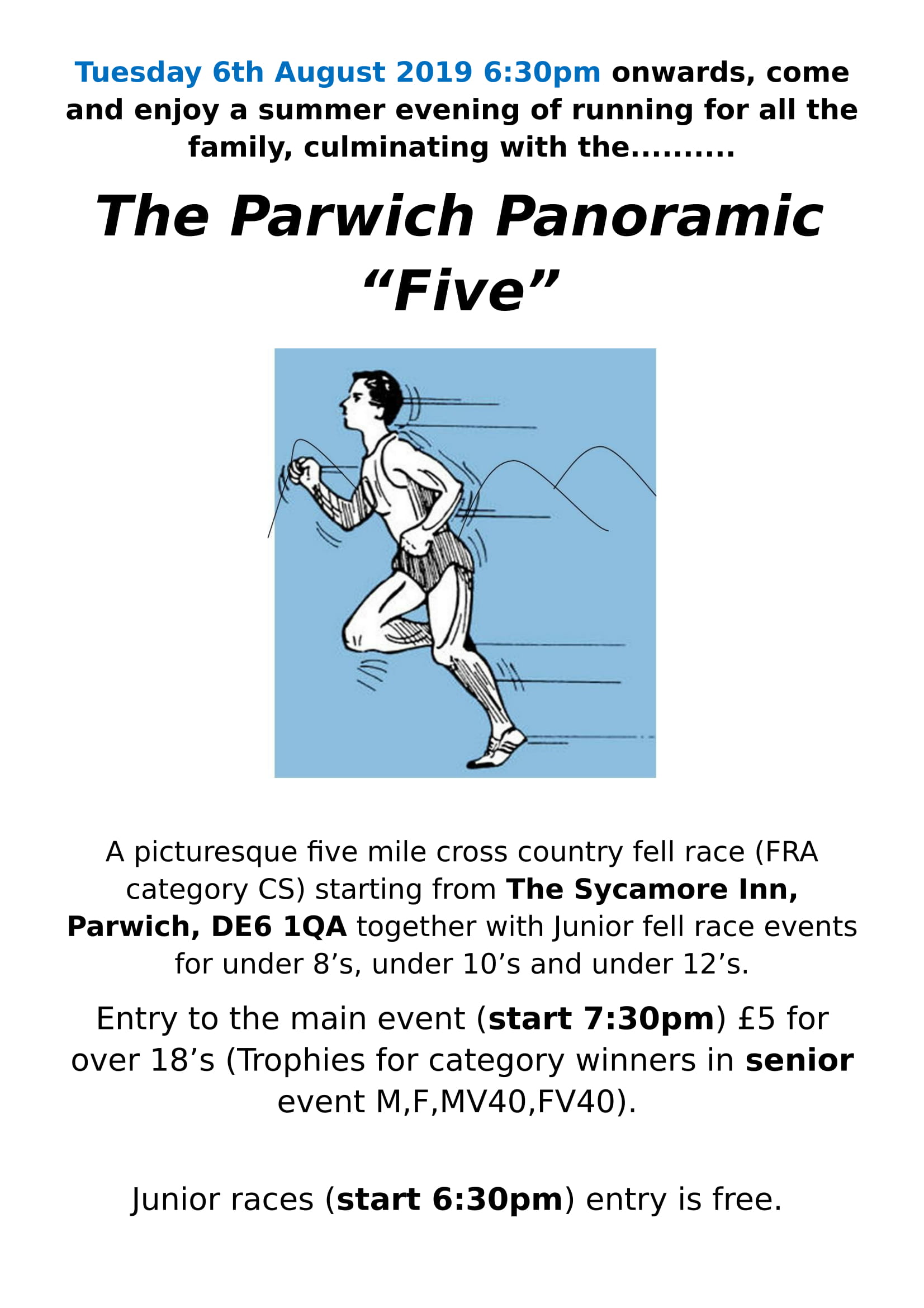
Posted in Out & About, Parwich Panoramic 5, Walks & Rides on Sunday August 4, 2019| Leave a Comment »
Posted in Out & About, Parwich Panoramic 5, Walks & Rides on Monday July 29, 2019| Leave a Comment »
Posted in Out & About, Parwich Panoramic 5, Walks & Rides on Monday July 22, 2019| Leave a Comment »
Posted in Out & About, Parwich Panoramic 5, Walks & Rides on Monday July 15, 2019| Leave a Comment »
Posted in Events, Parwich Panoramic 5, Walks & Rides on Monday July 8, 2019| Leave a Comment »
Posted in Events, Out & About, Walks & Rides on Saturday June 1, 2019| Leave a Comment »
Thank you David G for sending in these Tissington Well Dressing photos.
Can you spot Moss having a cool down?


Posted in Out & About, Peak Park, Transport, Walks & Rides on Friday November 30, 2018| Leave a Comment »
| New recycled surface for Tissington Trail during winter closure |
|
A 1.4 mile section of the Tissington Trail we be closed temporarily from 7 December 2018, to allow surfacing and improvement works to take place. The Peak District National Park Authority confirmed the section involved will run from the Thorpe Car Park, and end at Spend Lane Bridge. Works are expected to be completed by the end of February 2019. The closure will see re-surfacing – including the use of 100% recycled, WRAP (Waste Protocols Project) approved aggregates, a widening of the route to support its multi-user status, and associated ditch and drainage works. The temporary closure will also allow tree safety management to take place. |
Posted in Sport, Walks & Rides on Tuesday August 28, 2018| Leave a Comment »
Posted in Eating Out, Food Corner, History, Planning, Services, Walks & Rides on Sunday April 1, 2018| 4 Comments »
Starbucks?
Many residents will be familiar with the Limestone Way that traverses through Parwich but few will realise that 2020 will mark the 50th anniversary of its formal adoption as a long distance walking route. Much of the path has been used for 100s of years but it was only in 1970 that the route gained recognition as a long distance path. The trend to recognise such paths gave rise to the formation of the LDWA (Long Distance Walkers Association) in 1972. To mark the 50th anniversary of the path the LDWA have been looking for ways improve the walker experience and facilities along the route. As you are no doubt aware the recent activity by OpenReach around the area has resulted in upgrades to cabling into the village with fibre optics, FTTC and FTTP technologies and the new GFast making the old telephone exchange obsolete. BT and OpenReach estimate that the exchange will no longer be needed from late 2019. This has presented the LDWA in partnership with the National Park, Derby Dales and Staffordshire Moorlands councils the opportunity to provide a much needed new facility along the Limestone Way without the need for new building work in a conservation area. According to information on display in the National Park office in Bakewell the telephone exchange will be converted into an information centre providing an exhibition of the history of the limestone way, a small franchised coffee shop and ladies/gents toilet facilities. The latter particularly important for the large number of young families and older ramblers passing through the village since the closure of the public facilities on Creamery Lane.
There are also plans to involve villages along the route in celebratory events throughout 2020.
Posted in Events, Walks & Rides on Friday March 30, 2018| Leave a Comment »
Eroica Britannia is keen to help local residents of Derbyshire enjoy the experience of the vintage bike ride and associated festival. This year the organisers are pleased to offer a special promotion to local residents. If the promotional code PCDISCOUNT2018 is entered onto the website www.eroicabritannia.co.uk when booking a Tier 2 three-day adult festival pass then the price is reduced by 50% to £17.50. (Note: this code expires on the 13th April). Remember Kids aged 12 and under are FREE
Posted in Sport, Walks & Rides on Thursday February 16, 2017| Leave a Comment »
Nordic Walking in the Derbyshire Dales
Derbyshire Dales District Council is planning to add Nordic Walking to its popular Walking for Health programme this spring.
A series of one-hour taster sessions for the free walks are planned in Whitworth Park, Darley Dale from 10.00am – 3.00pm on Wednesday 22 February and Tuesday 21 March. The sessions will be run by trained International Nordic Walking Federation Instructors and walking poles will be provided.
Nordic Walking has proven benefits for many health conditions including arthritis, osteoarthritis, fibromyalgia, diabetes, cancer, cardiovascular disease, Parkinson’s disease, pulmonary disease, and menopause. It is suitable for people of all ages and fitness levels. Classes range from gentle walks for people with health concerns, to workout walks, which are a great way to improve fitness, lose weight and tone the whole body.
To book a place on one of the taster sessions please contact Becky Burton at becky.burton@derbyshiredales.gov.uk or phone 01629 761225. To find out more visit www.derbyshiredales.gov.uk/NordicWalking
Posted in Peak Park, Walks & Rides on Friday January 20, 2017| Leave a Comment »

Trail resurfacing set to improve access in the Peak District National Park
More of the High Peak Trail will be widened and resurfaced this winter, improving safety and enjoyment for visitors to the Peak District National Park.
About 2.3km (1.5 miles) of the trail between Newhaven Crossing and Minninglow car park is being improved. Work will begin on Monday (23 January) with repairs scheduled for completion by 17 February 2017.
Use of this section of the trail will be restricted at times but will remain passable.
Parts of the trail on that section are just 750mm wide in places, which is not enough to accommodate walkers, cyclists and horse riders at busy times. The improvements will mean the trail is widened to a width of at least 3 metres.
Emma Stone, who manages the Peak District National Park trails, said: “This is a trail with a variety of users and widening it to a minimum of 3 metres should make the whole experience much safer and more enjoyable for everyone.’’
The work is part of a rolling programme to improve safety and accessibility on the traffic-free trails in the UK’s first and original National Park.
The High Peak Trail runs for 27 km (17 miles) from Dowlow, near Buxton, to High Peak Junction at Cromford. It follows the former route of the High Peak Railway line, which opened in 1831 to carry minerals and goods between the Cromford and Peak Forest canals. Following the closure of the line, the Peak District National Park bought the part of the route within its boundary in 1971 and turned it into a traffic-free trail. The section from Daisy Bank, Longcliffe, to High Peak Junction is outside the national park and owned by Derbyshire County Council.
For more information on the Peak District’s traffic-free trails, visit www.peakdistrict.gov.uk/trails.
Posted in Classified adverts, Walks & Rides on Tuesday March 24, 2015| 1 Comment »
We have two international volunteers from Germany staying with us the weekend of the Well Dressings. We’d like to walk over hill and dale to get to Tissington, the only thing stopping us is two pairs of wellies – I need a size 39 and size 40 to borrow. Does anyone have some they can lend us?
Many thanks,
Debbie W 390568
Added 26th March: Debbie says thank you, the wellies are now sorted.
Posted in Walks & Rides on Sunday January 18, 2015| Leave a Comment »
Edith, Saskia and Fiona are hoping to do regular walks on a Friday (weather permitting). Anyone is welcome to walk with us either on a regular or occasional basis. The first will be on this Friday (23 Jan), a walk of about 5 miles to Tissington. Meet at 9.00am at the Pump Shed.
Posted in People, Walks & Rides on Sunday December 28, 2014| Leave a Comment »
Thank you to Lynn C for these photos of today’s Christmas outing – and thanks to the Legion for organising the walk. It was thoroughly enjoyed by all.

Posted in Peak Park, Walks & Rides on Thursday November 6, 2014| Leave a Comment »
| Peak District is first National Park to go live on Google Street View |
|
People can now take a tour of the Peak District National Park from the comfort of their own home. In true pioneering spirit, the Peak District today (Thursday) became the first national park to be virtually accessible, opening its diverse landscapes to the digital world of Google Street View. People will be able to click and see the traffic-free trails at home, at work or even on the move. Jim Dixon, chief executive of the Peak District National Park, said: “It is our ambition that, by being on Google Street View, more people will enjoy the wonders of this protected and special landscape. Once people see it, I am sure they will be inspired to come and stay for a few days to explore first-hand what they have experienced online. “The national park covers an area of 555 square miles so it was impractical to film every inch for people to view. Instead we have selected some of the highlights. These are the trail areas where we offer ranger-led walks, family activities and cycle hire and bike maintenance, so there are lots of ways for people to enjoy and experience what the national park has to offer.” The Tissington, Monsal and High Peak trails are now all available online. The filming took place over the summer and was carried out by national park volunteers using the Google Trekker camera. The equipment is designed to capture 360 degree imagery in public locations. It was taken to locations the Google Street View car can’t reach. Emily Clarke from Google said: “We’re excited that the Peak District will be using the Street View Trekker so more of us can experience its famous trails and views from wherever we are.” |
Posted in Farming, Ornithology, Peak Park, Pets of Parwich, Walks & Rides on Thursday April 3, 2014| Leave a Comment »
Dog-walkers asked to keep pets on leads in countryside
Peak District dog-walkers are asked to keep their pets on short leads to protect young farm animals and wildlife during the breeding season of spring and early summer.
Most responsible dog-owners would be horrified if their pets injured newborn lambs or chicks but farmers have already reported such incidents in the Peak District National Park over the past few weeks. Declining birds such as lapwing, curlew and snipe which nest on the ground are particularly vulnerable to harm from dogs roaming free or on long leads.
Tara Challoner, Peak District Wader Recovery Project officer said:
You may not always be aware that birds are present which can easily lead you into thinking that the moors and fields are great empty places, perfect for letting your dog have a good run around. However many of these birds are in very serious trouble and we need to do all we can to ensure that they are not lost from our countryside forever.
Posted in Environment, Peak Park, Roads, Walks & Rides on Sunday January 12, 2014| Leave a Comment »
The Peak Park Authority has organised the installation today of two new wooden signs in Parwich village to mark the route of the Limestone Way: one replacing a metal sign by Dam Farm and Japonica, and the other a new one by Hallcliffe gate.


The wooden signs look more fitting than the metal ones, though it prompts the query as to why there isn’t coordination between the Highways (County Council) and the Peak Park, with perhaps some consultation with the Parish Council, to have all the footpath signs matching.
Posted in 2013, Alsop, History, Posts of Note, Transport, Walks & Rides on Sunday September 22, 2013| Leave a Comment »
The book ‘Rails to Ashbourne’ by Howard Sprenger is now published by Kestrel Railway books (click here for details). It contrasts the older Uttoxeter to Ashbourne line with the relatively more recent Ashbourne to Buxton line, now the Tissington Trail. Obviously this latter had a major local impact and much of the information and pictures in the book relate to our area. (If any of our readers get a copy we would be pleased to post a review of the book focusing on the nearby sections.)

Click on image to read the promotional flier as a pdf.
Posted in Sport, Walks & Rides on Tuesday July 23, 2013| Leave a Comment »
Female focus for District Council bike riding initiative
Three fabulous Derbyshire Dales locations are now hosting a new cycling initiative that focuses on women.
Following the launch in June at Carsington Water of the first in a series of women-only bike rides on safe trails led by a trained leader, the initiative has moved up a gear with new rides on the Monsal and Tissington Trails.
Suitable for beginners, the scheme is being organised by Derbyshire Dales District Council with partners British Cycling, Carsington Sports & Leisure, Monsal Trail Cycle Hire and the Peak District National Park Authority.
Local women can select their location every Monday, Tuesday and Wednesday from 10 to 11am. On Mondays, riders meet at Hassop Station; on Tuesdays it’s Carsington Water and on Wednesdays, the starting point for the Tissington Trail is Ashbourne Cycle Hire.
Small children are welcome and it’s just £6 to hire an adult bike and free to use your own. Trailers and child seats are also available to hire and booking is essential on 01629 540478 or email enquiries@carsingtonwater.com for Carsington, and by calling the District Council’s Youth Sports Development Officer Marie Widerman for the Monsal and Tissington Trails on 01629 761380 or email marie.widerman@derbyshiredales.gov.uk
Chairman of Derbyshire Dales District Council’s Communities Committee, Councillor Jennifer Bower said: “I’ve already tried the Carsington ride myself and had a great time. The District Council works hard to promote safe and healthy communities and these rides are a terrific way of getting more people active – and meeting new people – in a really enjoyable way.”
More information is available online at http://www.derbyshiredales.gov.uk/cycling.
Posted in People, Sport, Walks & Rides on Saturday April 13, 2013| Leave a Comment »

You may have noticed in this week’s Ashbourne News Telegraph that our own Mike G-P is to cycle from Land’s End to John O’Groats in September. He is part of a group of fund-raising cyclists called Six Fat Dads, hoping to collectively raise £60,000 for five local charities: Derby Breast Cancer Support, Derbyshire Leicestershire & Rutland Air Ambulance, Ashgate Hospice, Neuro Care and Derbyshire Community Foundation.
Sponsor and follow them on:
We will also try to keep you up dated here at parwich.org.
Posted in 2012, Competition, Posts of Note, Walks & Rides on Sunday September 9, 2012| Leave a Comment »
For those of you that enjoyed the Tour de France and the Cycling during the Olympics, the Tour of Britain Cycle Race is coming through the Peak District on Monday 10th September. The timings below are approximate. It is a chance to see Olympic Time Trial champion Bradley Wiggins and his Sky team-mate Mark Cavendish who are both competing in the event.
| 37.9km | Ashbourne | 11:13 |
| 51.1km | SKODA KoM, Alstonefield (Cat.1) | 11:30 |
| 57.9km | Warslow | 11:39 |
| 65.3km | SKODA KoM, Morridge (Cat.1) | 11:48 |
The first Category One SKODA King of the Mountains climb of 2012 takes the race into the Derbyshire Dales, with a steep opening through the village of Turnditch before levelling off considerably towards the top at Cross o ‘th Hands.
After descending into Ashbourne, a short, steep unclassified climb leads towards the Peak District National Park, followed up by a long, main road drag after Fenny Bentley that runs parallel to the Tissington Trail, a former railway line now popular with cyclists and walkers.
A left fork takes Stage Two down to the River Dove via a fast descent, with the route crossing the river before climbing instantly on the SKODA King of the Mountains climb of Alstonefield that takes the race into Staffordshire.
Tree-lined at the bottom the climb begins gently but steepens as it turns away from the Dove into a constant gradient. The summit comes in the attractive Peak District village of Alstonefield with the views opening of the countryside opening up as the race levels off heading towards Hulme End and the Manifold Valley.
Posted in 2012, Local Links, Out & About, Posts of Note, Walks & Rides on Monday September 3, 2012| Leave a Comment »
Courtesy of the Tom’s Barn blog, here’s a handy guide for thirsty walkers in search of a pint at The Gate, presented by Marion F-S.
Please click here to read the original post.
Posted in Competition, Sport, Walks & Rides on Thursday August 30, 2012| Leave a Comment »
For those of you that enjoyed the Tour de France and the cycling during the Olympics, the Tour of Britain Cycle Race is coming through the Peak District on Monday 10th September. The timings below are approximate. It is a chance to see Olympic Time Trial champion Bradley Wiggins and his Sky team-mate Mark Cavendish who are both competing in the event.
| 37.9km | Ashbourne | 11:13 |
| 51.1km | SKODA KoM, Alstonefield (Cat.1) | 11:30 |
| 57.9km | Warslow | 11:39 |
| 65.3km | SKODA KoM, Morridge (Cat.1) | 11:48 |
The first Category One SKODA King of the Mountains climb of 2012 takes the race into the Derbyshire Dales, with a steep opening through the village of Turnditch before levelling off considerably towards the top at Cross o ‘th Hands.
After descending into Ashbourne, a short, steep unclassified climb leads towards the Peak District National Park, followed up by a long, main road drag after Fenny Bentley that runs parallel to the Tissington Trail, a former railway line now popular with cyclists and walkers.
A left fork takes Stage Two down to the River Dove via a fast descent, with the route crossing the river before climbing instantly on the SKODA King of the Mountains climb of Alstonefield that takes the race into Staffordshire.
Tree-lined at the bottom the climb begins gently but steepens as it turns away from the Dove into a constant gradient. The summit comes in the attractive Peak District village of Alstonefield with the views opening of the countryside opening up as the race levels off heading towards Hulme End and the Manifold Valley.
Thank you to Roberto Buntingo for bringing this to our attention.
Posted in Peak Park, Walks & Rides on Tuesday August 14, 2012| Leave a Comment »
The public consultation on the draft five-year management plan for the trails is now open.
The Peak District National Park Authority owns and manages four multi-user recreational trails within the Peak District. These are:
•Tissington Trail
•High Peak Trail
•Monsal Trail
•Thornhill Trail
All four trails are popular with a wide variety of users, including walkers, cyclists and horse riders. As the trails are old railway lines, they offer easy-to-access routes within areas of beautiful landscape that are rich in wildlife and historic interest.
The Authority has prepared a draft management plan for the four trails to guide their management over the next five years. Recognising the importance of the trails to both locals and visitors from further afield, we would now like to give the public the opportunity to comment on the plan.
How to comment
1. Download a copy of the draft management plan
2. Email your comments to Abi Ball at: abi.ball@peakdistrict.gov.uk
3. The consultation period will run for six weeks until midnight on Monday 17 September 2012.
Posted in Environment, Films, Photography, Walks & Rides on Saturday January 21, 2012| Leave a Comment »
Two rather lovely YouTube videos, from Peak District TV & Peak District OnLine, were sent into the Blog.
On a misty morning in the Peak District, the mysteriously named Chrome Hill and its neighbour Parkhouse, near Longnor, are brought to life. Like a weary dinosaur, Chrome Hill appears to be sleeping. The spines on its back are grit stone, tough and hard wearing, but ready for the fight. Both hills have views to die for and the scenery is simply breathtaking.
The majestic Roaches, on the western edge of the Peak District, north of Leek, rise out of the mists revealing a walker’s eye view from the top. The contorted stones are contrasted against the warmth of the sun, the heather a warm burnt amber amongst the bleak grey of the rock, a super area to walk.
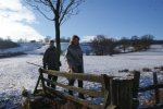
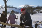
Posted in 2011, Photography, Posts of Note, Walks & Rides on Sunday December 25, 2011| 2 Comments »
This is the 4th year some of us have got together to do a Christmas morning walk. Everyone brought a contribution for the “picnic”, there were plenty of nibbles of lots and lots of mulled wine.
Posted in History, Peak Park, Walks & Rides on Tuesday August 23, 2011| Leave a Comment »
Families, residents and holidaymakers are invited to join a guided cycle ride to celebrate 40 years of the Peak District National Park Authority’s Tissington Trail.
This free event on Tuesday August 30th will explore the history of this popular traffic free trail – one of the first of its kind in the UK when it first opened in 1971.
The ride will be led by national park staff and is suitable for people of all ages whether new to cycling or experienced pedal-pushers.
One of the highlights of the tour is a visit to the Hartington signal box.
The ride starts at 11am. Meet at Parsley Hay cycle hire centre (SK17 ODG for satnavs). There is no need to book, people can bring their own bike or hire one from the cycle hire centre.
Property Manager, Abi Ball, who manages the Tissington Trail, said: “This year, visitors will be able to see conservation management in action, as for the first time sheep grazing will take place on the sides of the trail.”
The sheep will graze at Fenny Bentley Cutting and Parsley Hay Cutting from late summer and over winter, eating this year’s grass growth and helping to control the spread of scrub, for the benefit of next year’s wild flowers, such as orchids, bistort, knapweed and cowslips. Both cuttings will be fenced to keep the sheep in. This work has been funded by the SITA Trust which supports projects that make lasting improvements to the natural environment and community life.
Click here for a Brief history of the Tissington Trail.
Posted in Peak Park, Walks & Rides on Monday August 8, 2011| Leave a Comment »
A survey will be held on four recreational trails in the Peak District National Park to get views on how they could be improved in the future.
Trails Saturday is being organised by the Peak District National Park Authority on Saturday 20 August to ask users what they most like about the trails and to get their ideas on what would make them even better.
Staff will be collecting the views of walkers, cyclists and horse riders between 10am and 4pm at:
• Ashbourne Cycle Hire Centre on the Tissington Trail, a 13-mile route from Ashbourne to Parsley Hay
• Parsley Hay Cycle Hire Centre on the High Peak Trail, a 17.5-mile route from High Peak Junction, near Cromford, to Dowlow, six miles south of Buxton
• Millers Dale Station on the Monsal Trail, a 9-mile route between Bakewell and Wye Dale
• Carr Lane car park on the Thornhill Trail, a route which goes from Ladybower Dam towards Bamford station.
Abi Ball, who manages the trails for the Peak District National Park Authority, said: “All four trails are well used because they are easy access routes along old railway lines in beautiful national park countryside that is rich in wildlife and historic interest.
“The recent opening of the former railway tunnels on the Monsal Trail has really generated a lot of interest and use of all of the trails.
“We want to build on that interest by preparing a five year management plan for the trails. Because of their importance to locals and visitors alike, we would like to give as many people as possible the opportunity to feed their views directly into the process.”
Anyone who is unable to visit the survey points on Trails Saturday can still give their views by completing a short online survey.
The survey will be available until the end of August. All ideas given in the survey and on Trails Saturday will shape the new management plan.
For further information, please email Abi Ball at abi.ball@peakdistrict.gov.uk or ring 01629 816345.
Posted in 2011, Farming, Flora, Peak Park, Posts of Note, Walks & Rides on Tuesday July 5, 2011| 1 Comment »

More than 20 people from Parwich and Tissington met up in the Bletch Brook Valley with representatives from the National Park, to look at the wild flowers and find out about the elusive water vole.
Some of the best wild flower meadows are owned by Parwich United Charities (see photo below) and wonderfully managed by local farmers who over recent years through positive husbandry have brought back mixed hedgerows and increased the number of flowers dramatically. The reddish brown hue is bentgrass which follows the ridges of the ridge and furrow system in this field. One farm alone in the valley has over 200 mature trees, including 17 different species, this is considered remarkable for such a small area.

Thank you to Lynn Burrow, our local ranger for organising last night’s delightful free walk and to the experts, for their fascinating insight to the area and to all the farmers who look after this valley.
Photos – JaneB & Patti
Posted in Environment, Events, Peak Park, Walks & Rides on Thursday June 23, 2011| Leave a Comment »
A free guided walk through wildflower-rich hay-meadows, and the chance to search for the elusive “Ratty”, is on offer on Monday July 4th in the Bletch Brook Valley, between Parwich and Tissington.
Peak District National Park ecologists and experts from the Derbyshire Wildlife Trust will lead the walk, looking out for rare species including the water vole, known as “Ratty” in Kenneth Grahame’s Wind in the Willows. One of the UK’s most threatened species, the water vole has disappeared from 90 per cent of sites it occupied over the last 60 years. But it does survive in pockets of the Peak District National Park – including the Bletch Brook Valley.
The two-hour walk starts from two meeting places, both at 6.30pm on July 4: outside the Sycamore Inn in Parwich, and in front of Hand’s Well in Tissington. There is no need to book. Dogs should be on leads. If you have any questions, please call 01298 84992.
Posted in 2011, Out & About, Peak Park, Posts of Note, Walks & Rides on Saturday May 14, 2011| Leave a Comment »
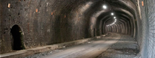
Four former railway tunnels are ready to re-open to walkers, cyclists and horse riders, following a major renovation project. Transport minister Norman Baker will officially open them on Wednesday May 25th. Update: Norman Baker will not be attending the opening after all.
The tunnels – Headstone, Cressbrook, Litton and Chee Tor – each measure between 400 and nearly 500 metres. They run from south of Bakewell to approximately three miles south of Buxton. Having been shut to the public when the Midland Railway closed in 1968, they have now been cleared out, repaired and resurfaced, with new lighting installed.
Nearly 1.5 miles of extra public access has been created. This extends the existing Monsal Trail, which runs from Bakewell to the edge of Buxton.
The project has been undertaken with the needs of cyclists in mind. Two new cycle hire businesses, at Blackwell Mill and Hassop Station, have been set up along the Monsal Trail to cater for those who wish to explore the new routes. Information panels and audio listening posts have also been provided.
Click here for more information, including maps and leaflets.
Posted in 2011, Alsop, Environment, Offers, Out & About, Peak Park, Posts of Note, Walks & Rides on Friday May 13, 2011| 1 Comment »
 PARWICH.ORG has been contacted by Steve Garidis of the Electric Bicycle Network, which is part of a major initiative to create a network of electric bikes and charging points across the Peak Park, copying similar schemes in Switzerland and Germany etc. Steve says:
Have you seen cyclists whizzing past, seemingly unconcerned about hills and headwinds? If so, they are probably on one of the new electric bicycles available for hire from hotels, self catering cottages, campsite and cycle hire centres around the Peak District.
Part of the Electric Bicycle Network launched in the Peaks this Spring. This new technology means that pretty much anyone can get into the great outdoors on two wheels. Why not give it a try? Bikes are available to hire at Carsington Water and our own Rivendale Camping and Caravan Park in Alsop-en-le-Dale.”
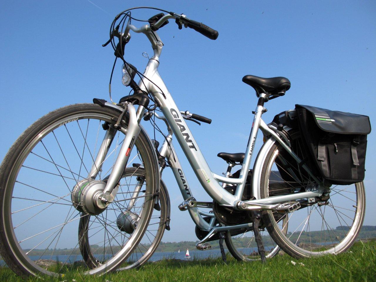
To promote this new initiative, two electric bikes have been made available for free trial at Carsington Water, exclusively to PARWICH.ORG readers, in return for a review on this site. This offer is strictly on a first come, first served basis.
If you’d like to try one of these bikes out, and if you’re happy to write a review of your experience for PARWICH.ORG, then please e-mail the blog team and we’ll put you in touch.

Posted in 2011, Posts of Note, Walks & Rides on Thursday March 24, 2011| 1 Comment »
Electric Bike Network – “It’s cycling – but not as we know it. Electric bicycles dismiss headwinds and flatten hills. Anyone can now enjoy the great outdoors on two wheels.”
Having received an invitation to attend the small and informal launch at Carsington Water of the Electric Bicycle Network, I decided to go along and find out more about this social enterprise. The launch is supported by the Carsington Water sports centre.
The aim of this initiative, well established in other, hilly(!) countries such Switzerland, is to establish a network of hire-points, such as campsites, B&B’s, s/c cottages, hotels, and charge points, such as pubs, cafés etc., i.e. anywhere where the cyclist may want to stop off to enjoy lunch or refreshments.
Whilst the launch was primarily aimed at representatives of visitor accommodation, pubs, cafés etc., there may also be some interest amongst local residents.
As a potential ‘Hire point’, it is very doubtful that participation by a single s/c cottage would bring in sufficient revenue from hiring out the bikes to guests to cover the cost of hiring (the minimum of) two electric bicycles from the support hub, i.e. Carsington Water, including back-up support etc. However, there may be potential for a cluster of visitor accommodation, which could possibly also be boosted by some local interest.
Further information can be found on the Electric Bicycle Network website.
I would be really interested to hear not only from other s/c cottages but also from local people who are mildly intrigued by this exciting initiative so I can gauge the level of interest in and around the village.
And yes, I had a go on one of the bikes, which was dead-easy to ride, and, whilst a little heavier than an ordinary bike, was much lighter than the older versions of electric bicycles.
Saskia Tallis (440)
Posted in Peak Park, Walks & Rides on Thursday March 17, 2011| Leave a Comment »
Sketch pads and pencils are needed for the next guided cycle ride on the Monsal Trail.
The Tour de Sketch ride, organised by the National Park Authority’s Pedal Peak District project, is to take place on Sunday March 27, 10am-3pm. Booking is essential, as spaces are limited, on start@pedalready.co.uk or 0114 2412775.
Pedal Peak District’s Carol Parsons said: “The Tour de Sketch ride is designed to encourage people to use their bikes for reasons other than for travel and fitness. This guided ride will be at a leisurely pace along the Monsal Trail with international ‘Sketch Crawl’ artist Lynne Chapman and her roving sketchers.
“The ride will give people the opportunity to explore the architecture and landscape of the former railway line between Bakewell and Thornbridge by pedal and with their pencils!”
The event is free of charge but places must be pre-booked. Participants need to bring a sketchbook and pencil as well as their own bicycle. The event will start from the car park at Hassop Station café and bookstore (DE45 1NW).
Pedal Ready trainers will be on hand to offer cycling advice and tips during the day.
*********************************************************************************************
The Peak District National Park Authority is improving the existing Monsal Trail between Bakewell and Wye Dale by opening new sections through the tunnels for cyclists, walkers and horse riders to use.
The work is part of the £2.25 million Pedal Peak District project, which has also included a marketing campaign to encourage more people to go cycling in the Peak District National Park.
The new route through the former railway tunnels is expected to open to the public in May or June, this year
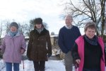
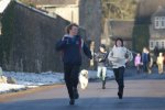
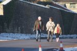
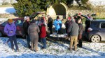
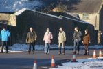
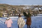
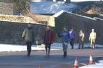
Posted in 2010, People, Photography, Posts of Note, Walks & Rides, Young people on Saturday December 25, 2010| Leave a Comment »
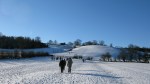
Thirty five friends took the morning air and walked to Tissington today for the 3rd annual Christmas day walk – some for the first time. It was a beautiful walk, with perfect blue skies and snow lining the fields. On arrival at Tissington, a picnic table ladened with nibbles and flasks of coffee and mulled wine greeted the walkers. Thank you to everyone who provided the goodies – roll on the next walk.


Posted in Ballidon, Local Links, Out & About, Walks & Rides on Thursday December 9, 2010| Leave a Comment »
Regular reader Helen K has spotted a featured “four churches walk” in today’s Guardian online travel section, which starts at Brassington, then takes in Ballidon, Parwich and Bradbourne. The walk is nine miles long, and the feature contains a link to a route map. Click here to take a look.


You can follow @parwichblog on Twitter, and you can also "like" us on Facebook.